
Spend less time searching
Bring selected assets into view automatically so you can focus on their condition and surroundings.
Vidgeo
View and navigate standard and 360° video by location, feature, or route, all within ArcGIS.
Walk, drive, or fly through your site as if you are there. Select an asset or location on the map to jump to the relevant footage, or follow video along a mapped route.
Schedule a Vidgeo demo“At Pickett and Associates, an ESP Company, we use Nodeology to capture 360° video along transmission corridors, allowing engineers to review sites in ArcGIS. The system improves safety, speeds up design workflows, and enhances communication with clients. It provides near-real-time situational awareness, like an up-to-date Google Street View for our job sites, making it a very high-impact tool for construction monitoring.”
 View full size ↗
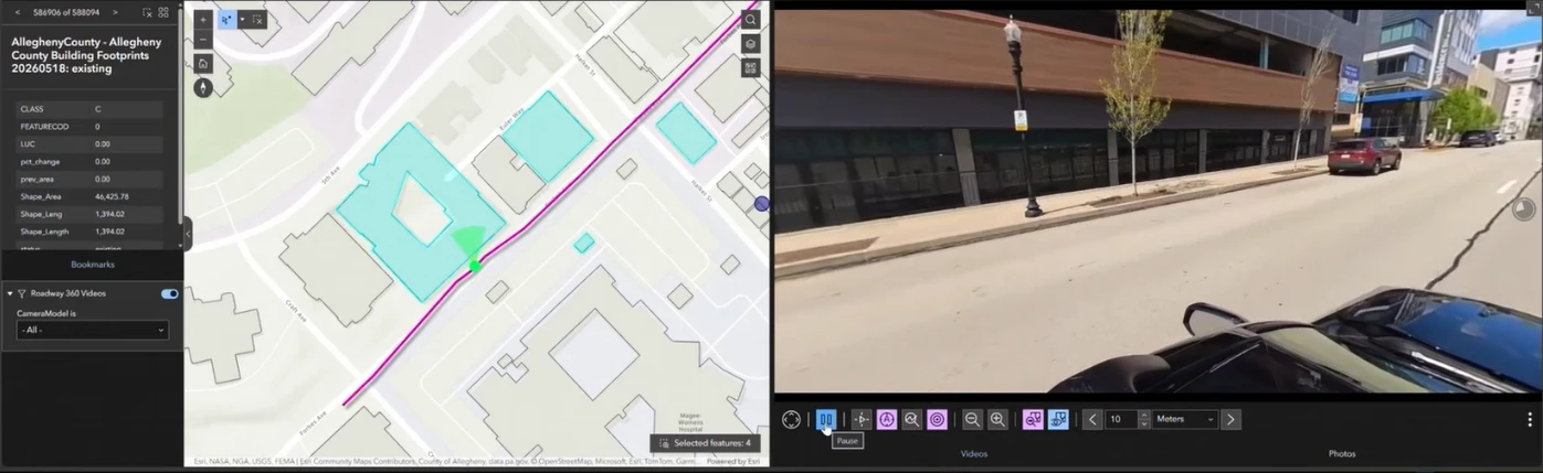
Map-based video review / Look at Selection
Reviewing 360° video shouldn’t mean constantly rotating the view to find the asset you need to review. Select the GIS features you want to review, and Vidgeo’s Look at Selection feature keeps them in view as the video plays.
Bring selected assets into view automatically so you can focus on their condition and surroundings.
Follow a set of selected features along the recorded route as Vidgeo moves between them during playback.
Keep a sign, utility asset, road segment, or inspection area in view as the recording approaches and moves past it.
Review recorded conditions remotely, identify concerns, and determine where a closer look is needed onsite.
How Look at Selection helps
Point features stay centered, linear assets remain in focus, and areas such as parcels are framed using their full extent. You can adjust how far ahead the view looks to keep the selected asset visible as the camera passes.
Use it to review utility assets, signs, culverts, valves, road segments, parcels, and inspection areas in 360° video.
Standard and 360° video
Use video from 360° cameras, drones, dashcams, or mobile devices. Bring recordings into ArcGIS to navigate and review conditions by location.
Review roads, rail corridors, signs, and utilities with their surrounding conditions in view.
Share a location-based visual record for planning, progress reviews, and project discussions.
Record field conditions and revisit locations to review observations in their geographic context.
Review and verify AI results
Vidgeo doesn’t detect anything. When your AI workflow produces mapped detections, Vidgeo takes you to the footage behind each one so a person can check it.
Bring geographic detections from your existing AI processing workflow into a Vidgeo application.
Select a detection to navigate to the corresponding location in the geographically connected recording.
Compare the result with what the camera captured. Check the detected feature and its surroundings to decide whether the finding needs correction or further review.
In the field / Oakmont storm damage
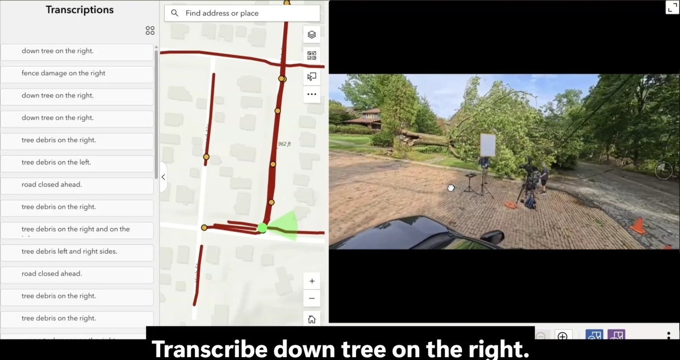
Following severe storms in Oakmont, Nodeology collected 360° video while recording spoken observations of damage along the route.
After recording, Geotagged Media Tools’ Transcribe Audio to Points converted those observations into geographically located map points. In Vidgeo, reviewers could select an observation to navigate to the corresponding footage and see the damage in context.
Together, the tools brought field notes, video, and location into one ArcGIS experience, helping teams find and review documented damage without searching through entire recordings.
 View full size ↗
Live video in ArcGIS
Connect fixed camera networks and mobile field feeds to your ArcGIS map. Find the view you need by location and review live conditions alongside your GIS information.
Live camera networks
Bring live camera feeds into ArcGIS so teams can review conditions alongside roads, assets, incidents, and operational layers.
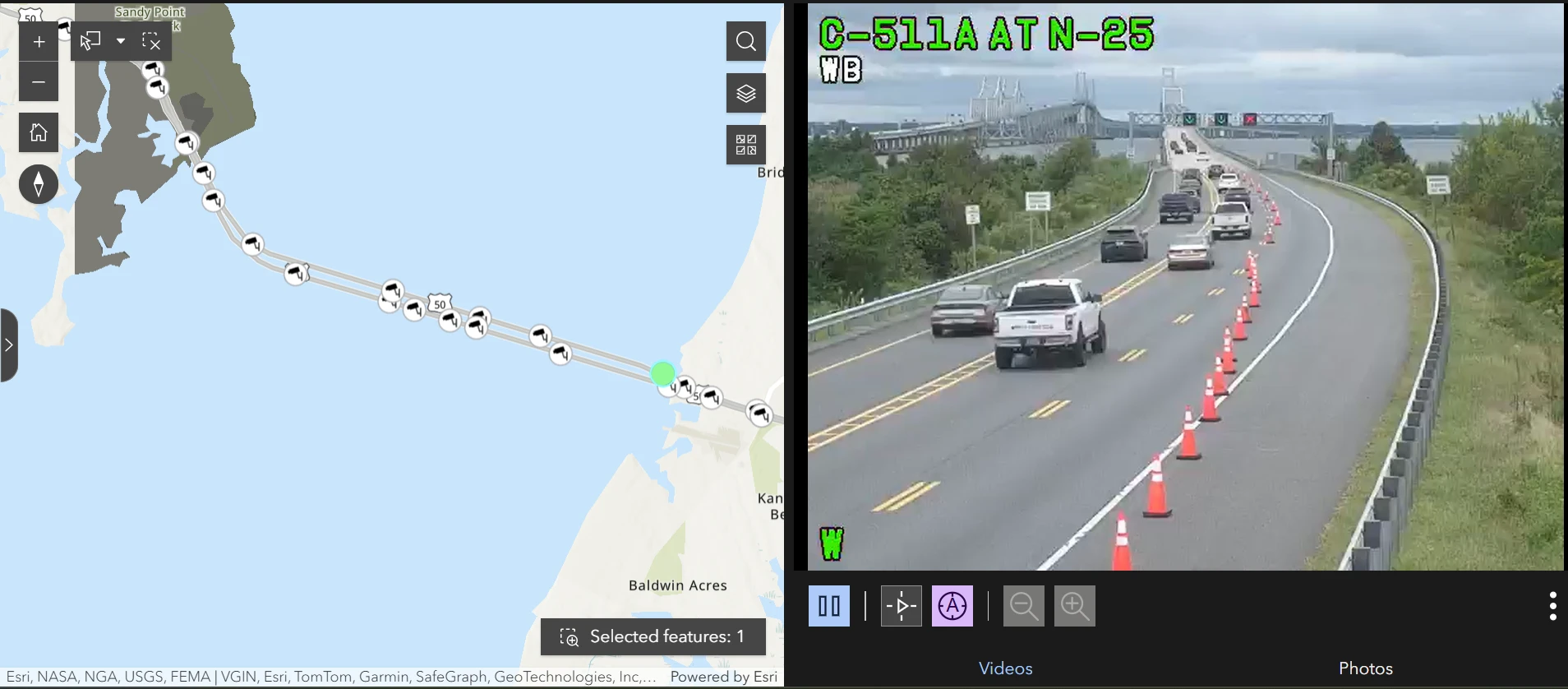
Vidgeo connects the camera’s location with its live feed, helping users find the view they need directly from the map.
 View full size ↗
A Nodeology demonstration connects more than 550 Maryland Department of Transportation traffic cameras to an ArcGIS map. Select a camera to view its live feed.
Open the traffic camera demo ↗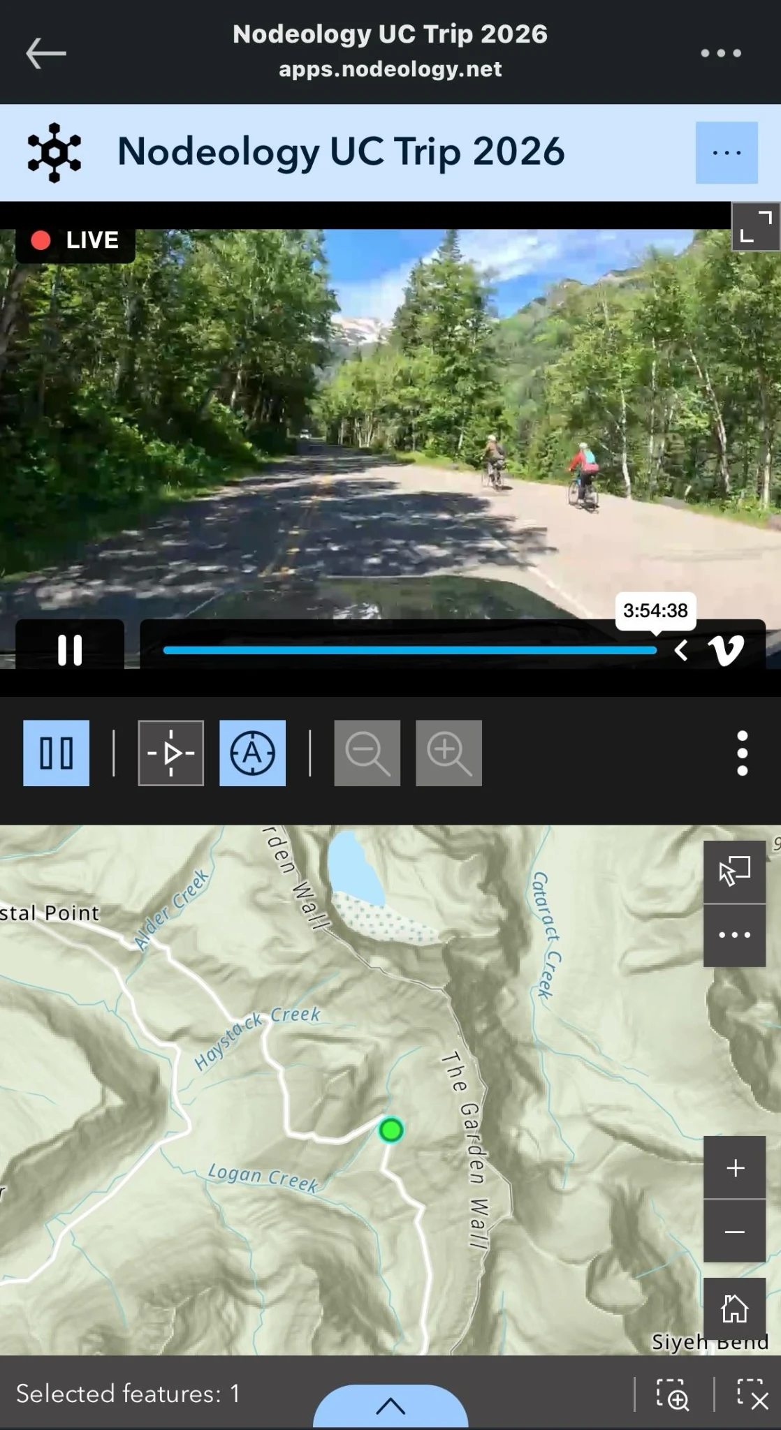 View full size ↗
Mobile field teams
Combine a live video stream in Vidgeo with a continuously updated vehicle location feed in ArcGIS. Office teams can see what the field crew is seeing and where they are while work is underway.
The crew’s camera streams over cellular or Starlink, and their position updates on the map as they move.
 View full size ↗
Conduct remote site reviews and collaborate with field personnel while they drive or walk a project site.
Give incident teams live visual context alongside operational layers, critical infrastructure, and evacuation routes.
Capture and review roadway and infrastructure conditions while crews are still in the field.
Connect with Geotagged Media Tools
Geotagged Media Tools can power a workflow that processes recordings, connects them to geographic locations, and publishes them for viewing in Vidgeo while fieldwork continues.
Plan your workflow
Experience Builder, video the app can reach, and a feature layer that ties the recording to its locations or route. Live video also needs a stream, a location feed, and an internet connection in the field.
Vidgeo supports standard and 360° video. Use standard video to review the recorded camera view, or 360° video to look around the scene. Look at Selection and viewing-angle controls apply to 360° recordings.
Yes. Vidgeo connects live feeds, from fixed cameras or vehicles in the field, to their mapped locations, so users select a location on the map and watch its feed.
Video stays on any web or cloud hosting that allows a web application on another domain to fetch its files.
Yes. Vidgeo was built to take full advantage of Experience Builder, so your existing layers, maps, selections, filters, and widget actions all work with it.
Vidgeo works in ArcGIS Experience Builder workflows connected to ArcGIS Online or ArcGIS Enterprise. Builds are provided for Experience Builder Developer Edition 1.14 through 1.20, matching ArcGIS Enterprise 11.3 through 12.1. For ArcGIS Online, the app is built with Developer Edition and hosted on your own web server.
The other tools
Evaluate with your own media
Bring a sample of your video and your ArcGIS environment. We’ll show you how Vidgeo can fit into your existing workflow.
See Vidgeo with your video